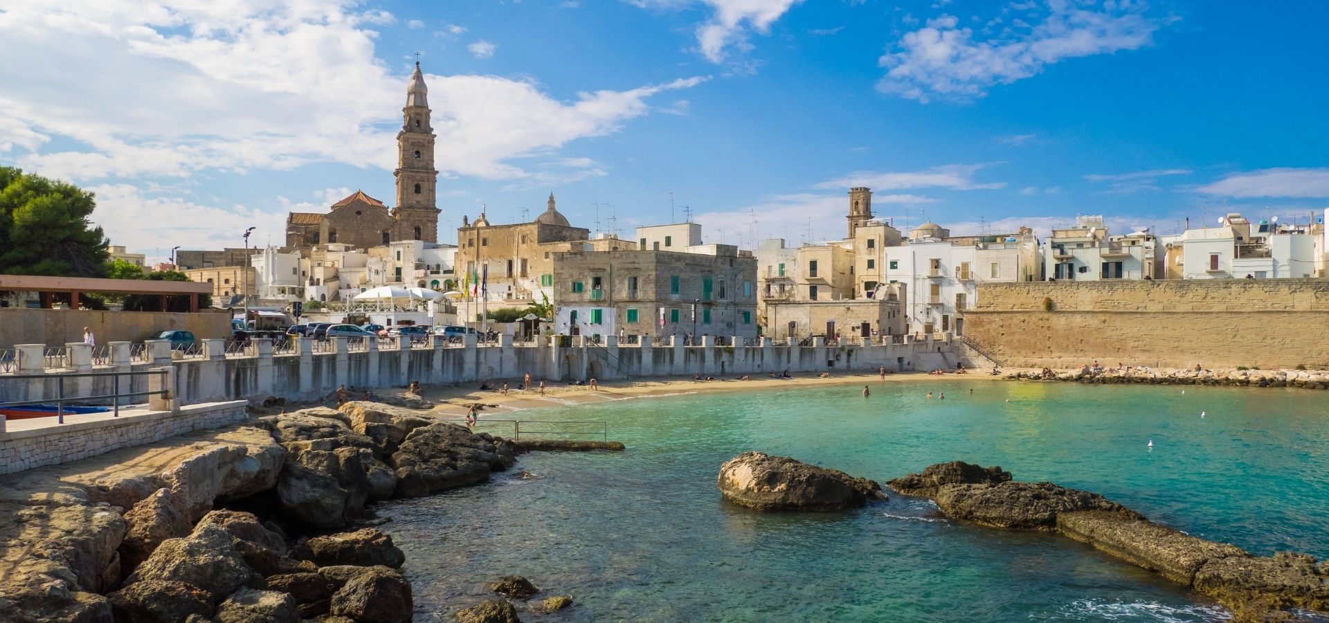
Monopoli (AFI: [mo’nɔpoli]; Menopele or Mnopl in Monopoli dialect) belongs to the metropolitan city of Bari, in Apulia, which is 41 km away, falling within the Conca in the south-eastern sector.
Origins of the name
There is no certainty either about the ancient place name or the origin of the current name of the city. What is certain is that a settlement surrounded by walls already existed in the 5th century BC, dating back to the Messapian era. The Tabula Peutingeriana, from the late Roman era, only shows that in those years, approximately in the area of present-day Monopoli, there was a centre called Dertu.
To date, several etymologies have been proposed, none of which are truly convincing.
From the Greek Μίνωος Πόλις: City of Minos
According to this hypothesis, it was the Cretan king Minos who founded it, as some claim, referring to the inscription transcribed by Abbé de Saint-Non in his work, a copy of which, cited by Theodor Mommsen as forged (an unconfirmed hypothesis), can be found in the sacristy of the Cathedral. After all, we must not forget the Messapian origins of Monopoli.
From the Slavic term field: City of Caves
A name that recalls primitive urban living conditions, whose population had settled in coastal caves.
From the Greek Μόνη Πόλις: Lonely City
Dionysius II of Syracuse is said to have founded two colonies on the coast of Apulia: Polisnea (Polignano) and Monopoli, the latter built on the ruins of Dertu. Since Monopoli was the only port between Siponto and Brindisi for the Syracusans, they called it the 'Lonely City'.
From the Greek Μόνη Πόλις: in the sense Cimportant city
A large Messapian fortress, as it probably appeared to the Egnati, who settled there following the destruction of their city by Totila, king of the Goths.
From the Greek Μονής Πόλις: City as a place to stop
The reference is once again to Monopoli's uniqueness as a port between Siponto and Brindisi, but in this case emphasising its status as one of the few landing places on the dangerous western coast of the peninsula.
From a suggestive term, Manopoli: with reference to hand shape that the headlands and inlets of the urban coastline have.
The Piedmontese cartographer Giacomo Gastaldi uses it, as does a map from the State Archives in Florence, dating back to 1400. Probably due to Florentine or Venetian influence, the same name Manopoli is also found in other nautical charts from the 16th century. Two hundred years earlier, the Latin version was widespread: Monopoly. The scholarly language continued with the use of the term Monopolis, declining it in the Greek manner (Monopoleos, etc.).

Notes on geography
The relief of the capital slopes down towards the coast, forming a steep step renamed The Greenhouses.
The slope, which can be seen close to the centre, becomes almost a watershed between the flat landscape (the navy) which extends towards the water and, conversely, a raised area which – almost like a plateau – reaches the interior, rising to 408 metres in the Carbonara mountains, in the Aratico district.
This conformation is due to erosion caused by the sea and confirms the uplift that affected the Murge during the Pliocene, emerging in its highest part.
The city's coastline stretches for about 15 kilometres, low and jagged, offering over twenty-five coves and wide sandy beaches, perfect for seaside tourism, including underwater exploration. The coastal plain is also dotted with farms and centuries-old olive trees, gnarled and imposing, also shaped by the wind and time. Almost a living testimony to the territory.
Flora (predominant)
Olive trees, together with almond trees, are the predominant crops, but they are also accompanied by vegetables and fruit trees such as citrus, cherry and fig trees. The Mediterranean scrub remains the most prevalent spontaneous vegetation.
- Coastal area
juniper, mastic, thyme, phillyrea, caper
- Lowland
olive tree, carob tree, almond tree, fig tree, prickly pear tree, caper bush
- Hilly slopes
holm oak, oak, wild olive, mastic tree, rockrose, terebinth
- Plateau
holm oak, oak, fragno, downy oak, almond tree, olive tree, vine, cherry tree, fig tree
There are also valuable botanical species that thrive – about 6 km from the town centre – in the Monte San Nicola wildlife oasis, which is of great naturalistic value and offers a sublime view of the marina below and the neighbouring towns.
Karst phenomena
- Voragine dell'Impalata: It opens at the bottom of a large sinkhole and is characterised by the presence of a perfectly vertical shaft with an almost circular cross-section, approximately 2 metres in diameter, which reaches a depth of 97.30 metres.
At approximately 83 metres, there is a short, high corridor measuring almost 40 metres, which is quite dangerous due to the presence of carbon dioxide. At the bottom of the shaft, there is a horizontal corridor where the oxygen percentage is more acceptable.
- Cave of Saint Lucy: large and complex karst system that is characterised by the presence of the second largest cave in Italy.[12] The entrance to the Santa Lucia Cave is located 375 metres above sea level and consists of a vertical shaft with a diameter of approximately 1.1 metres and a depth of 25 metres, which emerges after intersecting a small ledge, on the vault of a colossal cave with a vaguely elliptical shape in horizontal section, measuring approximately 170 by 56 metres. Various altimetric, morphological and geological clues suggest that this imposing complex of caves, corridors and chasms is only a section of a large underground watercourse, currently completely dry at the levels explored, which, starting from the plateau and sinking much lower, heads towards the Pirro canal to reach the bottom of the large sinkholes present there.
- Voragine della Cavallerizza. From a sinkhole, also located in the Monopoli area, not far from the historic Cavallerizza farm, you can access a complex system of wells and corridors, which is still active today, characterised by the presence of water in pools and an intermediate lake, until it reaches, with a final and deepest well of 170 metres perfectly vertical, a lake located about 300 metres below the entrance level.


